ISRO assesses Dharali damage post flash flood
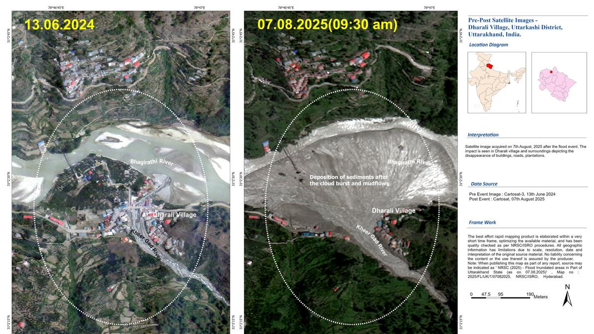
ISRO/NRSC used Cartosat-2S data to assess the devastating Aug 5 flash flood in Dharali & Harsil, Uttarakhand. Source: X/isro The Indian Space Research Organisation’s (ISRO) National Remote Sensing Centre has done a “rapid assessment” of the damage caused by the flash floods in Uttarkashi district of Uttarakhand using very high-resolution images from the Cartosat-2S satellite. … Read more